

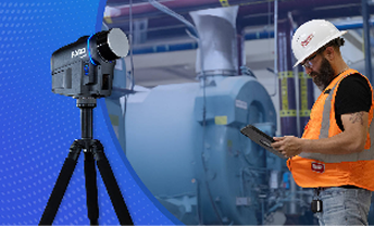
In modern construction and infrastructure delivery, accuracy and speed are not “nice to have”—they directly impact cost, coordination, safety, and timelines. For decades, total stations and manual measurement have been the standard. Today, LiDAR (3D laser scanning) is changing how teams capture site reality and turn it into usable data for design, execution, and handover.
So what’s better—LiDAR or traditional surveying? The right answer depends on your project type, the deliverables you need, and how much risk you can afford from missing or incomplete site data.
What is LiDAR (3D Laser Scanning)?
LiDAR (Light Detection and Ranging) uses laser pulses to measure distances and create a dense 3D dataset of the physical environment. The output is a point cloud (millions of points) that can be converted into CAD drawings, BIM models, and eventually digital twins.
- Primary output: point cloud (e.g., E57/RCP/LAS depending on workflow)
- Secondary outputs: as‑built drawings, Scan‑to‑BIM models, deviation checks
- Best for: complex sites, MEP-heavy environments, brownfield upgrades, progress & deviation monitoring
What is Traditional Surveying (Total Station / Manual Methods)?
Traditional surveying typically uses total stations, levels, GNSS, and manual measurement to capture discrete points. This is reliable for control points, boundaries, setting out, and simpler layouts. However, it often captures fewer points compared to LiDAR—which can leave gaps in complex environments.
- Primary output: point coordinates, levels, boundaries, layouts
- Best for: setting out, control networks, small/simple surveys, budget-limited scopes
- Limitations: fewer data points, multiple revisits, higher risk of missed geometry in complex areas
LiDAR vs Traditional Surveying: Quick Comparison
Factor | Traditional Surveying (Total Station / Manual) | LiDAR / 3D Laser Scanning |
Accuracy / detail | Good for discrete points; depends on point density and method | Dense capture; supports mm‑level detail where required and feasible |
Speed on complex sites | Often slower due to multiple setups and revisits | Faster coverage—large zones captured in one mobilisation |
Completeness | Selective point capture (risk of missing elements) | Captures “everything visible” for auditability |
Outputs | 2D layouts, coordinates, levels | Point cloud, 3D model, as‑built BIM/CAD, deviation reports |
Cost | Lower upfront | Higher upfront, but often reduces rework and downstream costs |
Best-fit projects | Small/simple or control/setting-out work | MEP-heavy, brownfield, fast-track, coordination-critical projects |
LiDAR vs Total Station: What Actually Changes on a Project?
The main difference is not the instrument—it’s the quality and completeness of data you bring into the project. LiDAR produces a verifiable 3D record that multiple teams can reference. This reduces design assumptions, coordination clashes, and disputes over what exists on site.
Where LiDAR wins (most of the time)
- Brownfield renovations where drawings are outdated or missing
- Industrial plants with dense piping, cable trays and equipment
- Hospitals, airports, data centres and MEP-heavy buildings
- Progress capture, deviation checks (designed vs built), and evidence packs for billing/claims
Where traditional surveying still wins
- Control points and setting out (construction layout)
- Small land surveys and simple geometry
- When outputs are only discrete points/levels and budgets are very tight
Real‑World Scenario (Example): Brownfield Industrial Renovation
In brownfield environments, the biggest risk is incomplete information. Traditional surveying may require multiple revisits and still miss hidden or congested geometry. LiDAR can capture a complete 3D record quickly, which can then be converted into an accurate BIM model for clash checks and planning.
- Traditional-only approach: multiple visits • selective capture • higher chance of missed elements • more rework risk
- LiDAR approach: full capture • BIM/CAD outputs • earlier clash detection • faster coordination
How LiDAR Fits Scan‑to‑BIM and Digital Twin Workflows
LiDAR becomes more valuable when you connect it to downstream digital workflows. A common lifecycle path is:
- LiDAR scanning → registered point cloud
- Point cloud → Scan‑to‑BIM (Revit/IFC) or CAD deliverables
- Designed vs built comparisons (for deviations and quality control)
- As‑built handover with asset data (COBie/CSV)
- Digital twin for operations (assets, documents, ticketing, compliance, and optional IoT)
Decision Checklist (Choose the Right Method for Your Project)
Use this checklist to decide quickly:
- Do you need complete geometry (not just points)? → choose LiDAR
- Is the site complex/MEP-heavy/brownfield? → choose LiDAR (often hybrid with control survey)
- Do you need Scan‑to‑BIM, clash detection, or digital twin readiness? → choose LiDAR
- Is the job mostly setting out / control points / boundaries? → traditional surveying is appropriate
- Do you expect billing/claims disputes where evidence matters? → LiDAR supports evidence packs and auditability
Frequently Asked Questions
Is LiDAR always more accurate than a total station?
They solve different problems. Total stations are excellent for precise discrete points and control. LiDAR captures dense geometry and can achieve very high detail where required and feasible, but it depends on workflow, setup, and site conditions.
Can LiDAR replace traditional surveying completely?
Usually not. Many projects use a hybrid: traditional survey for control and set‑out, and LiDAR for complete as‑built capture and downstream CAD/BIM outputs.
What deliverables can I get from LiDAR?
Common deliverables include point clouds, CAD drawings, Scan‑to‑BIM models (Revit/IFC), deviation reports, and datasets ready for digital twin platforms.
When does LiDAR deliver ROI?
ROI is strongest where rework is expensive: brownfield upgrades, complex MEP coordination, fast‑track schedules, and projects needing progress/deviation monitoring.
How do I get started?
Start with a pilot zone or a single building. Define outputs (CAD/BIM), accuracy/tolerance, and reporting needs (progress, deviation, billing packs).
