

Introduction
Construction projects rarely end exactly as they were originally designed.
During construction, changes can occur because of:
- Site conditions
- Design modifications
- MEP coordination
- Structural changes
- Contractor decisions
- Material availability
- Existing-condition constraints
- Client requirements
As a result, the final constructed environment may differ from the original architectural, structural or MEP drawings.
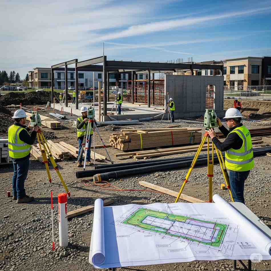
An as-built survey documents what actually exists on site after construction or modification.
It provides an accurate record of the constructed or existing conditions that can be used for future renovation, maintenance, facility management, design and engineering work.
Modern as-built surveys increasingly use technologies such as 3D laser scanning, SLAM, LiDAR, photogrammetry and surveying equipment to capture detailed spatial information.
What Is an As-Built Survey?
An as-built survey is a professional survey conducted to document the actual physical conditions, dimensions, locations and features of a completed or existing structure, facility or site.
Instead of asking:
“What was designed?”
an as-built survey answers:
“What is actually there?”
For example, an original drawing may show a pipe at one location.
During construction, the pipe may have been moved.
The as-built survey captures the actual installed position.
This information becomes a reliable reference for future work.
As-Built Survey vs As-Built Drawings
These terms are related but not identical.
As-Built Survey
The data collection and measurement process used to capture actual site conditions.
As-Built Drawings
The drawings or documentation produced from that information.
The workflow can be:
Existing/Constructed Site
↓
Survey
↓
Point Cloud / Measurements
↓
Data Processing
↓
CAD / BIM Documentation
↓
As-Built Drawings / Model
Therefore, an as-built survey can be the foundation for creating accurate as-built drawings and BIM models.
Why Are As-Built Surveys Important?
1. They Document Actual Site Conditions
Construction drawings may become outdated after modifications.
An as-built survey creates a current record of the physical environment.
This is particularly important for:
- Renovations
- Extensions
- Retrofitting
- MEP modifications
- Industrial upgrades
- Facility management
2. They Reduce Design Uncertainty
Imagine an architect is designing a renovation using drawings that are 10 years old.
The drawings show:
Wall location → 5.2 m
But the actual wall is:
5.05 m
That difference can affect:
- Layout
- MEP routing
- Equipment placement
- Structural design
- Material quantities
Accurate existing-condition information allows designers to work from better data.
3. They Support Renovation Projects
Renovation projects often involve existing buildings where documentation is:
- Missing
- Incomplete
- Outdated
- Inaccurate
An as-built survey can establish the current condition before design begins.
This can reduce reliance on assumptions.
4. They Help With MEP Coordination
Existing MEP systems can be complicated.
A facility may contain:
- HVAC ducts
- Water pipes
- Fire systems
- Electrical conduits
- Cable trays
- Drainage
- Mechanical equipment
An as-built survey can document their actual positions.
This information can then support engineering and BIM coordination.
5. They Support Facility Management
Once a building is occupied, accurate information about the physical asset remains valuable.
As-built information can support:
- Maintenance
- Asset management
- Space planning
- Future renovations
- Equipment replacement
- Facility upgrades
When combined with BIM and asset information, as-built data can become part of a broader digital facility-management workflow.
What Does an As-Built Survey Capture?
The exact scope depends on the project.
An as-built survey may document:
Architectural Elements
- Walls
- Doors
- Windows
- Floors
- Ceilings
- Staircases
- Facades
- Rooms
Structural Elements
- Columns
- Beams
- Slabs
- Foundations where accessible
- Structural steel
MEP Elements
- Pipes
- Ducts
- Cable trays
- Equipment
- Mechanical systems
- Electrical infrastructure
Site Elements
- Roads
- Drainage
- External structures
- Landscaping
- Levels
- Site boundaries where applicable
How Is an As-Built Survey Conducted?
Modern projects can use different technologies depending on their requirements.
1. 3D Laser Scanning
A terrestrial laser scanner captures millions of measurements from multiple positions.
The result is a detailed 3D point cloud.
Laser scanning is particularly useful for:
- Buildings
- Industrial facilities
- MEP
- Complex structures
- Detailed as-built documentation
2. SLAM Scanning
SLAM scanners can be carried through a building while continuously capturing spatial data.
This can be useful for:
- Large interiors
- Buildings
- Warehouses
- Complex facilities
- Rapid existing-condition capture
SLAM can reduce field setup time, although its suitability depends on the required accuracy and project conditions.
3. Drone LiDAR
For large outdoor areas, drone LiDAR can capture:
- Terrain
- Infrastructure
- Large sites
- Elevation
- Difficult-to-access areas
It can complement ground-based surveying and scanning.
4. Photogrammetry
Photogrammetry uses overlapping photographs to generate:
- 3D models
- Point clouds
- Orthomosaics
- Textured models
It can be particularly useful for:
- Large outdoor sites
- Facades
- Heritage documentation
- Visual documentation
5. Conventional Surveying
Depending on the project, conventional surveying equipment such as:
- Total stations
- GNSS receivers
- Levels
may be used to establish control or capture specific high-precision points.
The best approach may combine conventional surveying with reality-capture technologies.
The As-Built Survey Process
Step 1: Project Brief
The survey provider first determines:
- Project scope
- Survey area
- Required accuracy
- Required deliverables
- Coordinate system
- Level of detail
- Areas requiring special attention
Step 2: Review Existing Documentation
Available information may include:
- Architectural drawings
- Structural drawings
- MEP drawings
- Previous surveys
- BIM models
- Site plans
These documents provide context but should not automatically be assumed to represent current conditions.
Step 3: Site Inspection
The survey team assesses:
- Accessibility
- Safety
- Building layout
- Obstructions
- Existing conditions
- Required scanning routes
Step 4: Data Capture
Depending on the project, the team may use:
- Laser scanning
- SLAM
- Total station
- GNSS
- Drone LiDAR
- Photogrammetry
- or a combination.
Step 5: Registration & Processing
Collected data is processed into a unified dataset.
For laser scanning, multiple scan positions may need to be registered together.
Quality checks are then performed.
Step 6: Point Cloud Generation
The processed survey data can be converted into a registered 3D point cloud.
This becomes the spatial reference for downstream documentation.
Step 7: CAD / BIM Development
Depending on the scope, the point cloud can be used to create:
- Floor plans
- Elevations
- Sections
- Reflected ceiling plans
- MEP drawings
- Architectural CAD
- Revit models
- Structural models
Step 8: Quality Control
The final deliverables should be checked against:
- Survey data
- Control points
- Required tolerances
- Project specifications
Quality control is especially important when the data will be used for engineering or construction.
What Are the Deliverables?
As-built survey deliverables vary depending on the project.
1. Point Cloud
A registered 3D representation of the surveyed environment.
Possible formats can include:
- E57
- LAS/LAZ
- RCP/RCS
- Other project-specific formats
The appropriate format depends on the client’s software and workflow.
2. 2D CAD Drawings
Typical deliverables include:
- Floor plans
- Sections
- Elevations
- Roof plans
- Reflected ceiling plans
3. BIM Model
Depending on requirements:
- Architectural BIM
- Structural BIM
- MEP BIM
- Combined models
The required Level of Development/Detail should be defined before modeling begins.
4. Survey Control Data
Where applicable:
- Coordinates
- Benchmarks
- Control points
- Survey references
5. Orthophotos / Imagery
For appropriate projects, imagery can complement the survey data.
How Accurate Is an As-Built Survey?
There is no single accuracy standard that applies to every as-built survey.
Required accuracy depends on:
- Project type
- Survey technology
- Site conditions
- Required deliverable
- Scale
- Construction tolerance
- Client specifications
For example, an architectural floor plan may have different requirements from detailed industrial MEP documentation.
A professional survey specification should therefore define:
Required tolerance
↓
Survey methodology
↓
Equipment
↓
Control
↓
Quality assurance
This is more meaningful than simply saying:
“Our scanner is accurate to X mm.”
Factors Affecting As-Built Survey Accuracy
Several factors can affect the final result.
Equipment
Different scanners and surveying instruments have different specifications.
Survey Control
Control points can help establish and validate spatial accuracy.
Environment
Reflective surfaces, limited visibility, moving objects and difficult geometry can affect data collection.
Operator Experience
Scanning methodology and route planning influence data quality.
Registration
Poor registration can create errors between different scans.
Processing
Data cleaning, alignment and quality control are important parts of the workflow.
When Do You Need an As-Built Survey?
An as-built survey can be useful in many situations.
Before Renovation
When existing drawings are outdated.
Before Building Extension
To accurately document the existing structure.
Before MEP Upgrades
To understand existing systems and available space.
Before Industrial Plant Modification
To document complex equipment and infrastructure.
Before BIM Modeling
To provide accurate existing-condition data.
After Construction
To document the final constructed condition.
During Facility Management
To maintain an accurate digital record.
As-Built Survey for Renovation Projects
Renovation is one of the strongest use cases.
Suppose an architect receives drawings for a 20-year-old building.
The drawings show:
- Existing walls
- Structural columns
- MEP routes
But the building has been modified several times.
The architect cannot confidently determine which information is still correct.
An as-built survey can capture the current building.
The workflow becomes:
Existing Building
↓
3D Laser Scan
↓
Point Cloud
↓
As-Built CAD/BIM
↓
Renovation Design
This gives designers a much stronger starting point.
As-Built Survey for Industrial Facilities
Industrial facilities can be especially difficult to document because they may contain thousands of physical elements.
Examples include:
- Process piping
- Tanks
- Pumps
- Valves
- Structural steel
- Platforms
- Cable trays
- HVAC
- Equipment
3D laser scanning can capture these systems in a dense point cloud.
The data can then support:
- Plant modifications
- Equipment replacement
- Retrofit projects
- Engineering design
- Clash detection
- Maintenance planning
As-Built Survey and Scan-to-BIM
As-built surveys and Scan-to-BIM are closely connected but are not the same thing.
As-Built Survey
Captures:
Actual physical conditions
Scan-to-BIM
Converts:
Reality-capture data → BIM model
A typical workflow is:
Laser Scanning
↓
Point Cloud
↓
As-Built Survey
↓
Scan-to-BIM
↓
Revit Model
↓
Design / Coordination / Facility Management
This distinction is important when defining project scope and pricing.
As-Built Survey vs Traditional Measurement
Traditional measurement can work well for simple projects.
But complex buildings can contain thousands of measurements.
Manual Measurement
Can involve:
- Tape measurements
- Laser distance meters
- Manual notes
- Individual dimensions
Reality Capture
Can provide:
- Dense 3D data
- Comprehensive spatial documentation
- Digital reference
- Repeat measurement capability
For complex projects, reality capture can provide significant productivity advantages.
How Much Does an As-Built Survey Cost?
There is no universal price.
Pricing can depend on:
- Total area
- Number of floors
- Building complexity
- MEP density
- Site location
- Required accuracy
- Scanning technology
- Required deliverables
- Point cloud processing
- CAD requirements
- BIM requirements
- Project timeline
A point-cloud-only project will generally have a different scope from:
Scan → Point Cloud → Architectural CAD → MEP BIM
Therefore, clients should define the desired deliverables before comparing quotations.
How to Choose an As-Built Survey Company
Before hiring a provider, ask:
1. What technology will you use?
Laser scanning, SLAM, surveying, drone LiDAR or a hybrid workflow?
2. What accuracy can you achieve?
Ask for the expected project tolerance.
3. What are the deliverables?
Point cloud, CAD, BIM, survey drawings or all of them?
4. How will accuracy be validated?
Ask about control points and quality checks.
5. Can you work with BIM?
If you require Revit or another BIM platform, confirm the team’s modeling capabilities.
6. Can you survey MEP?
This is important for renovation and industrial projects.
7. What coordinate system will be used?
This matters when integrating the survey with existing engineering or GIS data.
8. How will the data be delivered?
Confirm file formats and software compatibility.
As-Built Survey Checklist
Before starting a project, define:
Project Information
- Site location
- Area
- Number of floors
- Building type
- Project purpose
Accuracy
- Required tolerance
- Survey control
- Coordinate system
Scope
- Architecture
- Structure
- MEP
- External areas
- Equipment
Deliverables
- Point cloud
- CAD
- BIM
- Survey drawings
- Reports
- Imagery
Project Requirements
- Site access
- Safety
- Working hours
- Completion deadline
A clear scope prevents misunderstandings and unexpected costs.
Frequently Asked Questions
What is an as-built survey?
An as-built survey documents the actual physical conditions of a completed or existing building, structure or site.
What is the difference between an as-built survey and an as-built drawing?
The survey is the data collection process. The drawing is a document created from the survey information.
Can laser scanning be used for as-built surveys?
Yes. 3D laser scanning is widely used for detailed existing-condition and as-built documentation.
Can an as-built survey create a BIM model?
Yes. Survey data and point clouds can be used as inputs for Scan-to-BIM modeling when the project requirements are properly defined.
How accurate is an as-built survey?
Accuracy depends on the technology, project requirements, environment, control and processing methodology. There is no single accuracy level for every project.
Do old construction drawings replace an as-built survey?
Not necessarily. Existing drawings may be outdated or inaccurate, particularly after years of modifications.
Can an as-built survey include MEP?
Yes. Depending on the scope and accessibility, MEP systems can be documented as part of an as-built survey.
Is an as-built survey necessary for renovation?
It can be extremely valuable when existing documentation is incomplete, outdated or unreliable.
How much does an as-built survey cost?
Cost varies based on area, complexity, accuracy, technology and deliverables. A project-specific quotation is generally required.
Conclusion
An as-built survey provides a reliable picture of what physically exists on a site or inside a building.
For construction, renovation, industrial, infrastructure and facility-management projects, accurate existing-condition information can help reduce uncertainty and provide a stronger foundation for design and engineering decisions.
Modern technologies such as 3D laser scanning, SLAM, drone LiDAR, photogrammetry and conventional surveying can be used individually or together depending on project requirements.
The most effective workflow is not necessarily the one using the newest technology.
It is the one that delivers the required accuracy, coverage and documentation in a format that the project team can actually use.
Planning a renovation, retrofit or construction project?
An as-built survey can provide the accurate existing-condition data needed before design or construction begins.
