

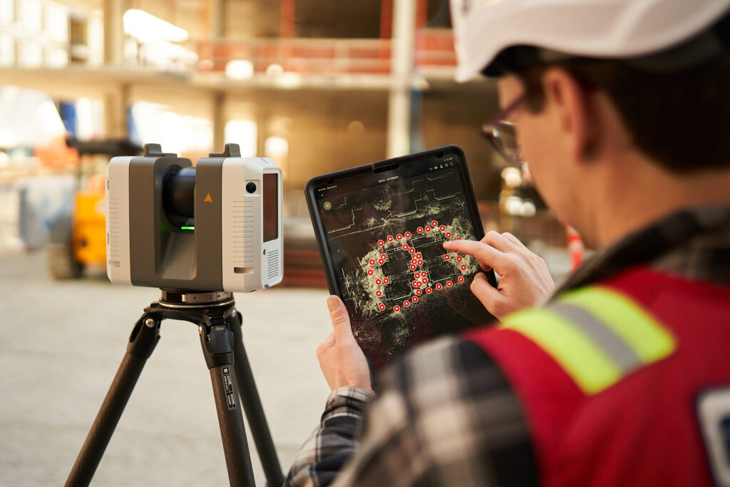
Introduction
Construction projects depend on accurate information about the physical environment.
Before designing, renovating, constructing or modifying a building, project teams need to understand what is actually present on site.
Traditional methods such as manual measurements and existing drawings can provide useful information, but they may become challenging when dealing with:
- Large construction sites
- Complex buildings
- Industrial facilities
- Dense MEP systems
- Irregular structures
- Existing buildings
- Difficult terrain
- Incomplete documentation
This is where reality capture in construction becomes valuable.
Reality capture uses technologies such as 3D laser scanning, SLAM, drone LiDAR, photogrammetry and GPR to collect information about physical environments and convert it into usable digital data.
The resulting data can support surveying, CAD, BIM, construction coordination, inspection, progress monitoring and digital twins.
This guide explains what construction reality capture is, how it works, the technologies involved, its benefits and where it can be used.
What Is Reality Capture in Construction?
Reality capture is the process of collecting digital information about a physical environment and converting it into a digital representation.
In construction, this can mean capturing:
- Buildings
- Structures
- Terrain
- Roads
- MEP systems
- Industrial equipment
- Infrastructure
- Construction progress
- Existing conditions
The captured information can be represented as:
- Point clouds
- 3D models
- Orthomosaics
- Digital terrain models
- Digital surface models
- CAD drawings
- BIM models
- Digital twins
A simple reality-capture workflow is:
Physical Site
↓
Reality Capture Technology
↓
Raw Data
↓
Processing & Registration
↓
Point Cloud / Survey Data
↓
CAD / BIM / 3D Model
↓
Construction Decision-Making
Why Is Reality Capture Important in Construction?
Construction teams often make decisions based on information collected at different stages.
If that information is inaccurate or outdated, problems can occur.
For example:
Old drawing
↓
Design based on incorrect dimensions
↓
Construction begins
↓
Existing condition discovered
↓
Design modification
↓
Delay + additional work
Reality capture helps provide a more current representation of the physical environment before important decisions are made.
It doesn’t eliminate every construction risk, but it can reduce uncertainty and provide better information for planning.
Technologies Used for Reality Capture
Reality capture isn’t one specific technology.
It is an ecosystem of technologies that can be selected according to project requirements.
1. 3D Laser Scanning
3D laser scanning uses laser pulses to measure the distance between a scanner and surrounding surfaces.
The measurements are converted into a detailed 3D point cloud.
Laser scanning is particularly useful for:
- Buildings
- Industrial plants
- MEP systems
- Structural documentation
- As-built surveys
- Renovation projects
- Scan-to-BIM
Typical workflow
Laser Scanner
↓
Multiple Scan Positions
↓
Registration
↓
Point Cloud
↓
CAD / BIM
One of its major advantages is its ability to capture complex geometry with a high density of measurements.
2. SLAM Scanning
SLAM stands for Simultaneous Localization and Mapping.
SLAM scanners are mobile systems that can capture 3D information while the operator moves through an environment.
They can be particularly useful for:
- Large buildings
- Warehouses
- Complex interiors
- Industrial facilities
- Existing-condition surveys
- Rapid site documentation
The major advantage is mobility.
Instead of setting up a scanner at every location, the operator can move through the space while continuously collecting data.
However, SLAM should be selected based on the required accuracy and project conditions.
3. Drone LiDAR
Drone LiDAR combines a drone with a LiDAR sensor to capture three-dimensional information from above.
It is particularly useful for:
- Large sites
- Infrastructure
- Mining
- Quarries
- Terrain
- Difficult-to-access areas
- Large construction projects
Drone LiDAR can produce:
- Point clouds
- Digital Terrain Models
- Digital Surface Models
- Elevation data
- Contours
It can also complement ground-based scanning.
4. Photogrammetry
Photogrammetry uses overlapping photographs to reconstruct three-dimensional information.
Images can be captured using:
- Drones
- Professional cameras
- Mobile devices
- Specialized imaging systems
Photogrammetry can generate:
- Point clouds
- 3D meshes
- Orthomosaics
- Textured 3D models
It is particularly useful for large outdoor sites and applications where visual information is important.
5. Ground Penetrating Radar (GPR)
GPR investigates subsurface and embedded features using electromagnetic radar signals.
It can help investigate:
- Underground utilities
- Pipes
- Electrical conduits
- Concrete reinforcement
- Embedded services
- Voids
- Subsurface anomalies
This makes GPR particularly useful before:
- Excavation
- Drilling
- Core cutting
- Piling
- Structural modifications
While other reality-capture technologies focus primarily on visible geometry, GPR can provide information about certain features below or within surfaces.
Reality Capture Technologies: Quick Comparison
| Technology | Best Used For |
| 3D Laser Scanning | Detailed buildings and structures |
| SLAM | Rapid mobile indoor capture |
| Drone LiDAR | Large areas and terrain |
| Photogrammetry | Visual and aerial mapping |
| GPR | Underground and embedded features |
| GNSS / Surveying | Control and geospatial positioning |
No single technology is ideal for every construction project.
In many cases, combining technologies produces a more comprehensive dataset.
What Is the Reality Capture Workflow?
A professional reality-capture project generally involves several stages.
Step 1: Define the Project Requirements
Before collecting data, determine:
- What needs to be captured?
- How large is the site?
- What accuracy is required?
- Is the project indoor or outdoor?
- What deliverables are required?
- Is BIM required?
- Is survey control required?
This step determines the appropriate technology.
Step 2: Site Assessment
The survey team evaluates:
- Site accessibility
- Existing conditions
- Terrain
- MEP complexity
- Vegetation
- Obstructions
- Safety requirements
- Environmental conditions
This helps determine the best scanning methodology.
Step 3: Technology Selection
Depending on the project, the team may select:
3D Laser Scanning
SLAM
Drone LiDAR
Photogrammetry
GPR
GNSS / Total Station
or a combination.
Step 4: Data Collection
The selected technology is used to capture the physical environment.
For example:
Building
→ Terrestrial Laser Scanning
Large Outdoor Site
→ Drone LiDAR + Photogrammetry
Complex Interior
→ SLAM + Laser Scanning
Underground Utilities
→ GPR
This project-specific approach is one of the biggest advantages of a professional reality-capture workflow.
Step 5: Data Processing
Raw data needs to be processed before it can be used.
Depending on the technology, this can include:
- Registration
- Georeferencing
- Noise filtering
- Classification
- Alignment
- Data cleaning
- Coordinate transformation
Step 6: Point Cloud Generation
One of the most common outputs is a 3D point cloud.
The point cloud provides a digital representation of the captured environment.
It can then become the foundation for:
- CAD
- BIM
- 3D modeling
- Measurement
- Inspection
- Documentation
Step 7: CAD and BIM Development
Point-cloud data can be converted into usable design information.
Potential deliverables include:
CAD
- Floor plans
- Elevations
- Sections
- Site plans
BIM
- Architectural models
- Structural models
- MEP models
- Coordination models
This is often referred to as a Scan-to-BIM workflow.
Step 8: Quality Control
Before delivery, the data should be checked against project requirements.
Quality control may include:
- Registration checks
- Survey control checks
- Accuracy validation
- Missing-data review
- Model-to-point-cloud comparison
The objective is to ensure the final deliverable is fit for its intended purpose.
Major Benefits of Reality Capture in Construction
1. Better Existing-Condition Information
Reality capture provides a digital record of what exists on site.
This is particularly useful for renovation and retrofit projects.
2. Faster Site Data Collection
Modern scanning technologies can collect large amounts of information quickly.
Instead of manually measuring hundreds or thousands of points, teams can capture a much larger dataset during a site visit.
3. Reduced Measurement Errors
Manual measurement can introduce errors through:
- Incorrect readings
- Transcription mistakes
- Missed dimensions
- Human error
Reality capture creates a digital dataset that can be revisited during downstream processing.
4. Better Design Coordination
Accurate existing-condition information can help designers coordinate proposed work with the physical environment.
This is particularly useful for:
- MEP coordination
- Structural modifications
- Equipment installation
- Renovation
- Retrofit projects
5. Supports BIM
Reality capture provides valuable data for BIM workflows.
A typical process is:
Reality Capture
↓
Point Cloud
↓
Scan-to-BIM
↓
BIM Model
↓
Design Coordination
↓
Construction
6. Supports Construction Progress Monitoring
Repeated reality-capture surveys can provide snapshots of site conditions over time.
These can be compared against:
- Previous surveys
- BIM models
- Construction schedules
- Design information
This can help project teams understand how construction is progressing.
7. Helps Identify Deviations
Reality capture can be used to compare:
As-Designed
vs.
As-Constructed
Potential applications include:
- Structural positioning
- MEP installation
- Wall locations
- Equipment placement
- Construction tolerances
The exact comparison methodology depends on the project specifications.
8. Better Documentation
Instead of relying solely on photographs and drawings, project teams can retain detailed digital spatial information.
This can become valuable later when:
- Renovating
- Maintaining
- Expanding
- Modifying
- Inspecting
the facility.
9. Safer Site Investigation
Some reality-capture technologies can collect information without requiring personnel to physically access every part of a site.
Examples include:
- Drone LiDAR for difficult terrain
- Laser scanning for complex structures
- GPR for subsurface investigation
However, technology does not remove the need for appropriate site safety procedures.
Reality Capture Use Cases in Construction
1. New Construction
Reality capture can support:
- Site surveys
- Topographic mapping
- Construction monitoring
- Progress documentation
- Quality control
2. Renovation and Retrofit
This is one of the strongest applications.
Existing buildings frequently have incomplete documentation.
Reality capture can establish current conditions before design begins.
3. MEP Coordination
Complex MEP systems can be documented using 3D scanning.
Captured information can support:
- HVAC
- Plumbing
- Electrical
- Fire protection
- Equipment coordination
4. Industrial Construction
Industrial facilities often contain complex systems.
Reality capture can document:
- Process piping
- Equipment
- Structural steel
- Platforms
- Tanks
- Mechanical systems
This information can support engineering and plant modifications.
5. Infrastructure Projects
Reality capture can support:
- Roads
- Rail
- Bridges
- Airports
- Tunnels
- Utility corridors
Large-area projects can benefit from combining aerial and ground-based technologies.
6. Construction Progress Monitoring
Repeated scans or drone surveys can provide a digital record of site progress.
For example:
Week 1
→ Capture
Week 4
→ Capture
Week 8
→ Capture
Week 12
→ Capture
The datasets can then be compared to understand changes over time.
7. As-Built Documentation
At the completion of construction, reality capture can help document the actual constructed environment.
A typical workflow is:
Completed Building
↓
Laser Scan
↓
Point Cloud
↓
As-Built CAD/BIM
↓
Final Documentation
This provides a digital record for future use.
Reality Capture and Scan-to-BIM
Reality capture and Scan-to-BIM are closely related.
Reality Capture
Captures:
The physical environment
Scan-to-BIM
Converts:
Reality-capture data into a BIM model
For example:
3D Laser Scan
↓
Point Cloud
↓
Architectural Modeling
↓
Structural Modeling
↓
MEP Modeling
↓
BIM Model
The required Level of Detail should be agreed before modeling begins.
Reality Capture and Digital Twins
Reality capture can also contribute to digital twin development.
A digital twin may combine:
- Reality-capture data
- BIM
- Asset information
- Sensor data
- Operational information
A simplified workflow is:
Physical Asset
↓
Reality Capture
↓
BIM / 3D Model
↓
Asset Information
↓
Digital Twin
This can support facility and asset-management workflows.
Reality Capture vs Traditional Surveying
Reality capture does not necessarily replace traditional surveying.
Instead, the two can complement each other.
Traditional Surveying
Strong for:
- Survey control
- Coordinates
- Boundaries
- Precise individual points
- Engineering reference
Reality Capture
Strong for:
- Dense spatial data
- Complex geometry
- Large datasets
- Existing-condition documentation
- 3D visualization
A hybrid approach can provide both survey control and comprehensive spatial information.
How Accurate Is Reality Capture?
There is no single accuracy level for reality capture.
Accuracy depends on:
- Technology
- Equipment
- Environment
- Survey methodology
- Control
- Processing
- Project requirements
For example, a high-precision terrestrial laser scan and a rapid SLAM survey may have different accuracy characteristics.
Therefore, the correct approach is to define:
Required tolerance → technology → methodology → validation
rather than choosing technology based solely on advertised specifications.
How Much Does Construction Reality Capture Cost?
The cost depends on:
- Site area
- Building complexity
- Location
- Required accuracy
- Technology
- Number of floors
- MEP density
- Site accessibility
- Required deliverables
- CAD/BIM requirements
- Project timeline
For example:
Point Cloud Only
will have a different scope from:
Laser Scanning → Point Cloud → CAD → Revit BIM Model
Similarly:
Drone LiDAR survey
will have a different cost structure from:
Terrestrial scanning of a complex industrial plant.
A project-specific assessment is therefore the best way to determine cost.
How to Choose a Reality Capture Company
Before selecting a provider, ask:
1. What technologies do you offer?
Look for providers capable of selecting the right technology rather than forcing every project into one workflow.
2. What accuracy can you achieve?
Ask for project-specific accuracy rather than generic equipment specifications.
3. What are the deliverables?
Clarify whether you receive:
- Point cloud
- CAD
- BIM
- Orthomosaic
- DTM
- DSM
- Survey drawings
4. Can you integrate different datasets?
This can be important for large projects requiring:
- Drone LiDAR
- Terrestrial scanning
- SLAM
- GPR
- Survey control
5. Do you provide Scan-to-BIM?
If BIM is part of the project, confirm the provider’s modeling capabilities.
6. How is quality controlled?
Ask about:
- Registration
- Control points
- Check points
- Accuracy validation
- Model verification
The Future of Reality Capture in Construction
Construction is moving toward increasingly data-driven workflows.
Reality capture is helping connect the physical project with its digital representation.
The future workflow increasingly looks like:
Physical Site
↓
Reality Capture
↓
Point Cloud
↓
BIM
↓
Construction Data
↓
Digital Twin
↓
Facility Management
Instead of collecting measurements once and storing them in a drawing, project teams can maintain digital information that can be reused throughout the asset lifecycle.
Frequently Asked Questions
What is reality capture in construction?
Reality capture is the process of digitally documenting physical environments using technologies such as laser scanning, SLAM, LiDAR, photogrammetry and GPR.
What is the most common reality capture technology?
3D laser scanning is widely used for detailed building and structural documentation, while other technologies are selected depending on the project.
Is reality capture the same as 3D laser scanning?
No. 3D laser scanning is one type of reality-capture technology. Reality capture is the broader concept that includes laser scanning, SLAM, drone LiDAR, photogrammetry and other methods.
Can reality capture be used for BIM?
Yes. Reality-capture data can be processed into point clouds and used as a foundation for Scan-to-BIM workflows.
Can reality capture reduce construction errors?
It can help reduce uncertainty by providing better information about existing conditions and supporting design and construction verification. It does not eliminate all construction errors.
Can reality capture be used for renovation?
Yes. Existing-condition documentation is one of its most valuable applications.
Can drones be used for reality capture?
Yes. Drones can carry LiDAR or cameras to capture large sites, terrain and infrastructure.
Can reality capture detect underground utilities?
Certain reality-capture workflows can investigate subsurface features. GPR is specifically used for this purpose, although detection capability depends on ground conditions and target characteristics.
How accurate is reality capture?
Accuracy depends on the technology, equipment, methodology, environmental conditions and project requirements.
Conclusion
Reality capture is transforming how construction and engineering teams collect, manage and use information about physical environments.
Instead of relying exclusively on manual measurements and existing drawings, project teams can capture detailed digital information using:
- 3D Laser Scanning
- SLAM
- Drone LiDAR
- Photogrammetry
- GPR
- Conventional Surveying
The resulting data can support:
Surveying → CAD → BIM → Construction → As-Built Documentation → Digital Twins
The most important point is that there is no single reality-capture technology that is best for every project.
A professional approach starts with the project requirements and then selects the appropriate technology—or combination of technologies—to achieve the required accuracy, coverage and deliverables.
For construction, infrastructure and industrial projects, reality capture can provide the reliable digital foundation needed to make better-informed decisions throughout the project lifecycle.
