

Introduction
Industrial plants are among the most complex built environments.
A single facility can contain thousands of interconnected components, including:
- Process piping
- Pumps
- Valves
- Tanks
- Pressure vessels
- Structural steel
- Platforms
- Cable trays
- Electrical systems
- HVAC systems
- Equipment
- Buildings and infrastructure
Over the years, plants are also modified, expanded and upgraded.
New equipment may be installed. Existing pipelines may be rerouted. Temporary structures may become permanent. Equipment may be replaced without updating all the original documentation.
Eventually, the drawings and models may no longer accurately represent the physical facility.
This creates a major challenge:
How do you create an accurate digital record of what actually exists inside the plant?
Modern digital documentation for industrial plants combines technologies such as 3D laser scanning, SLAM, LiDAR, photogrammetry, CAD, BIM and asset management systems to create a reliable digital representation of the physical facility.
This article explains how the process works—from capturing the plant with laser scanning to using the resulting information for engineering, maintenance and asset management.
What Is Digital Documentation for Industrial Plants?
Digital documentation is the process of capturing, organizing and maintaining information about an industrial facility in a digital format.
It can include:
- Geometry
- Dimensions
- Equipment locations
- Piping routes
- Structural information
- MEP systems
- Asset information
- Spatial relationships
- Existing conditions
Depending on the project, the final digital environment may consist of:
Point Cloud
→ CAD Drawings
→ BIM Model
→ Asset Database
→ Digital Twin
The objective is to create a reliable digital representation that can support the plant throughout its lifecycle.
Why Industrial Plants Need Digital Documentation
Industrial facilities continuously evolve.
A plant that was constructed 15 years ago may have undergone:
- Equipment replacement
- Process modifications
- Capacity expansion
- New pipelines
- Electrical upgrades
- Structural modifications
- Safety improvements
- MEP changes
But documentation doesn’t always evolve at the same speed.
This can result in:
Outdated Drawings
The drawing says one thing, while the plant contains something different.
Difficult Engineering
Engineers may need to spend significant time verifying existing conditions.
Installation Conflicts
New equipment or piping may conflict with existing infrastructure.
Maintenance Challenges
Teams may not have an accurate spatial reference for equipment.
Higher Project Risk
Uncertainty about existing conditions can affect design, planning and execution.
Digital documentation helps close this information gap.
3D Laser Scanning: The Foundation of Industrial Documentation
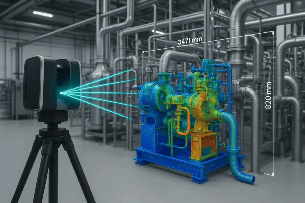
One of the most powerful technologies for industrial plant documentation is 3D laser scanning.
A terrestrial laser scanner captures millions of measurements from the surrounding environment.
The result is a detailed 3D point cloud.
For example:
Industrial Plant
↓
Multiple Laser Scans
↓
Registered Point Cloud
↓
Piping + Equipment + Structure
↓
CAD / BIM
This can capture complex geometry without requiring survey teams to manually measure every component.
What Can Laser Scanning Capture in an Industrial Plant?
Depending on accessibility and line of sight, laser scanning can document:
Process Equipment
- Tanks
- Pumps
- Compressors
- Heat exchangers
- Reactors
- Vessels
Piping
- Process pipes
- Utility pipes
- Flanges
- Valves
- Fittings
- Supports
Structural Systems
- Columns
- Beams
- Platforms
- Stairs
- Handrails
- Structural steel
MEP
- HVAC
- Cable trays
- Electrical infrastructure
- Fire protection
- Mechanical systems
Buildings
- Floors
- Walls
- Ceilings
- Doors
- Openings
- Roof structures
What Is a Point Cloud?
A point cloud is a collection of 3D points representing surfaces captured during scanning.
Each point can contain spatial information such as:
- X
- Y
- Z
- Intensity
- Classification
- Color, depending on the equipment
When millions of points are combined, the result can represent a detailed digital version of the physical facility.
Engineers can use the point cloud to:
- Measure distances
- Check clearances
- Identify geometry
- Create drawings
- Develop BIM models
- Compare design with existing conditions
From Point Cloud to Digital Documentation
Laser scanning is only the beginning.
The real value comes from converting the captured data into information that engineering and operations teams can use.
A typical workflow is:
Stage 1
Physical Plant
↓
Stage 2
3D Laser Scanning
↓
Stage 3
Registered Point Cloud
↓
Stage 4
CAD / BIM Modeling
↓
Stage 5
Asset Information
↓
Stage 6
Digital Plant Environment
↓
Stage 7
Asset Management
Scan to CAD for Industrial Plants
For projects that primarily require drawings, point-cloud data can be converted into CAD.
Typical deliverables include:
- General arrangement drawings
- Piping layouts
- Equipment layouts
- Floor plans
- Sections
- Elevations
- Structural drawings
- MEP documentation
This can be useful for engineering modifications and plant documentation.
Scan to BIM for Industrial Plants
For more complex projects, the point cloud can be converted into a BIM model.
A BIM model can represent:
- Equipment
- Piping
- Structures
- Buildings
- MEP systems
with structured digital elements.
The model can then support:
- Design coordination
- Clash detection
- Engineering
- Construction
- Maintenance planning
The required modeling scope and Level of Detail should be agreed before the project begins.
Industrial Plant Digital Twin
A digital twin goes beyond simply having a 3D model.
A digital twin may connect:
3D Geometry
BIM
Asset Information
Operational Data
Sensors / IoT
Depending on the implementation, this can create a digital environment that supports ongoing plant operations.
A simplified concept is:
Physical Plant
↔
Digital Representation
The digital representation can potentially be updated as the physical asset changes.
Digital Documentation Workflow for Industrial Plants
Let’s look at the complete process.
Step 1: Project Planning
Before scanning begins, the project team defines:
- Plant areas
- Required coverage
- Accuracy
- Deliverables
- Coordinate system
- Modeling requirements
- Required Level of Detail
Step 2: Existing Documentation Review
Available documents are collected.
These may include:
- P&IDs
- GA drawings
- Structural drawings
- Equipment layouts
- Previous surveys
- CAD files
- BIM models
These documents help the survey team understand the facility before collecting new data.
Step 3: Site Survey
The facility is inspected to determine:
- Access
- Safety restrictions
- Scan positions
- Obstructions
- Hazardous areas
- Equipment locations
- Required control
Step 4: 3D Laser Scanning
Multiple scan positions are established throughout the plant.
The scanner captures the visible environment from each position.
Overlapping scans help create comprehensive coverage.
Step 5: Registration
Individual scans are aligned into one unified point cloud.
This process is critical because registration errors can affect downstream measurements and modeling.
Step 6: Quality Control
The dataset is checked for:
- Coverage
- Registration
- Missing areas
- Control
- Accuracy
- Noise
Areas requiring additional scanning can then be identified.
Step 7: CAD or BIM Development
The point cloud becomes the reference for:
Scan to CAD
or
Scan to BIM
depending on the project’s requirements.
Step 8: Asset Information Integration
Equipment and other assets can be associated with relevant information.
For example:
Pump
→ Equipment ID
→ Location
→ Manufacturer
→ Model
→ Maintenance information
→ Relevant documentation
The exact asset information depends on the client’s systems and project scope.
Step 9: Asset Management
The digital documentation can then support ongoing:
- Maintenance
- Inspections
- Engineering
- Modifications
- Planning
- Asset management
How Digital Documentation Supports Plant Engineering
1. Brownfield Engineering
Brownfield projects involve modifications to existing facilities.
The biggest challenge is often:
Understanding what already exists.
Accurate laser-scanning data can give engineers a better starting point for modification design.
2. Plant Expansion
When a plant is expanded, new systems need to connect with existing infrastructure.
Digital documentation can help engineers understand:
- Available space
- Existing equipment
- Pipe routes
- Structural constraints
- Access paths
This can reduce uncertainty during design.
3. Equipment Replacement
Suppose a large pump needs to be replaced.
Engineers need to understand:
- Existing dimensions
- Connection points
- Clearance
- Access
- Supporting structures
- Pipe connections
A detailed point cloud can provide valuable spatial reference.
4. Piping Modifications
Industrial piping networks can be extremely complex.
Laser scanning can document:
- Pipe routes
- Elbows
- Flanges
- Valves
- Supports
- Connection points
The information can then support new piping design.
5. Clash Detection
When new systems are designed, they can be compared against the existing environment.
For example:
New Pipe
vs.
Existing Structure
vs.
Existing Cable Tray
vs.
Existing Equipment
A BIM-based coordination workflow can identify potential spatial conflicts before installation.
6. Maintenance Planning
Accurate digital information can help maintenance teams understand:
- Where equipment is located
- How equipment is connected
- Available access
- Surrounding structures
- Nearby systems
This can support planning before personnel enter the work area.
Digital Documentation for Shutdown and Turnaround Projects
Industrial shutdowns and turnarounds often involve a large amount of work in a short period.
Teams may need to:
- Replace equipment
- Modify piping
- Inspect structures
- Install new systems
- Upgrade infrastructure
Accurate pre-shutdown documentation can help teams prepare for the work.
A possible workflow is:
Pre-Shutdown Scan
↓
Point Cloud
↓
Engineering / BIM
↓
Modification Planning
↓
Shutdown Execution
↓
Post-Work Scan
↓
Updated As-Built Documentation
This can create a stronger record of what changed.
Pre-Engineering Using Laser Scanning
Before designing modifications, engineering teams can use point-cloud data to understand the existing environment.
This can reduce the need for repeated site visits for basic measurements.
Engineers can virtually examine:
- Clearances
- Pipe routes
- Equipment locations
- Structural geometry
- Access conditions
This can make early-stage engineering more informed.
Digital Documentation for Plant Safety
Digital documentation can also support safety planning.
For example, 3D data can help visualize:
- Access routes
- Equipment clearances
- Platforms
- Stairways
- Potential obstructions
However, digital documentation should complement—not replace—formal safety procedures and site assessments.
Combining Laser Scanning With Other Technologies
Laser scanning doesn’t have to work alone.
A comprehensive industrial documentation project may combine:
3D Laser Scanning
For detailed geometry.
SLAM
For rapid capture of large interior areas.
Drone LiDAR
For large outdoor areas and difficult terrain.
Photogrammetry
For imagery and textured models.
GPR
For underground or embedded investigation.
GNSS / Total Station
For survey control.
This creates a broader reality-capture workflow.
Industrial Plant Reality Capture Workflow
A large industrial facility could use:
Drone LiDAR
↓
Outdoor site + terrain
Terrestrial Laser Scanning
↓
Plant structures + equipment
SLAM
↓
Large interior spaces
GPR
↓
Underground utilities
↓
Unified Digital Dataset
↓
CAD / BIM / Asset Management
This hybrid approach can provide more comprehensive coverage than relying on a single technology.
Accuracy in Industrial Plant Documentation
Accuracy requirements should be established based on the intended use.
For example:
Visualization
May require less dimensional precision.
Engineering Design
May require tighter tolerances.
Equipment Installation
May require highly reliable dimensional information.
BIM
Requires an agreed modeling and survey tolerance.
Accuracy depends on:
- Scanner
- Survey control
- Scan geometry
- Distance
- Registration
- Environmental conditions
- Processing
- Quality control
A professional project should define the required tolerance before data collection begins.
What Are the Deliverables?
Industrial digital documentation projects can provide a range of outputs.
Point Clouds
For future measurement and modeling.
CAD Drawings
For engineering and documentation.
BIM Models
For coordination and design.
Equipment Models
For specific assets.
Piping Models
For process and utility systems.
Survey Data
For spatial control.
Orthophotos / Imagery
For visual reference.
Asset Database
For equipment and maintenance information.
Digital Twin
Where the project requires an integrated operational environment.
Digital Documentation and Asset Management
One of the biggest opportunities is connecting spatial information with asset information.
For example:
Physical Asset
Pump P-102
↓
Digital Representation
3D geometry
↓
Asset Information
- Equipment ID
- Manufacturer
- Specifications
- Location
- Maintenance history
- Inspection records
↓
Asset Management Platform
This allows the physical and informational aspects of an asset to be connected.
The exact implementation depends on the client’s existing asset-management software and data standards.
Benefits of Digital Documentation for Industrial Plants
Better Existing-Condition Information
Provides a detailed digital record of the facility.
Reduced Site Visits
Engineers can access digital information remotely for many measurement and planning tasks.
Faster Engineering
Point clouds and models can provide a stronger starting point for design.
Better Coordination
3D information makes spatial relationships easier to understand.
Reduced Rework
Better existing-condition information can help reduce design conflicts.
Improved Maintenance Planning
Asset locations and surrounding geometry can be documented digitally.
Better Lifecycle Information
The data can remain useful beyond the original engineering project.
Future-Proofing
A well-organized point cloud can become a valuable digital record for future projects.
Challenges and Limitations
Digital documentation is not without challenges.
Large Data Volumes
Industrial scans can generate very large point-cloud datasets.
Complex Geometry
Dense piping and equipment can make interpretation difficult.
Line of Sight
Laser scanning cannot capture surfaces that are hidden from the scanner.
Hazardous Areas
Special procedures and appropriate equipment may be required in hazardous environments.
Data Management
Point clouds, CAD, BIM and asset data need to be organized properly.
Model Development
Creating a detailed BIM model from point-cloud data can require significant time and specialist expertise.
Data Maintenance
A digital model becomes less useful if major physical changes are made but the digital record isn’t updated.
How to Choose an Industrial Scanning Company
Before hiring a provider, ask:
- Do you have experience with industrial plants?
- What laser-scanning equipment do you use?
- Can you work in complex piping environments?
- How do you establish survey control?
- What accuracy can you achieve?
- Can you provide registered point clouds?
- Do you offer Scan-to-CAD?
- Do you offer Scan-to-BIM?
- Can you model piping and equipment?
- Can you integrate with existing BIM models?
- Can you combine laser scanning with drone LiDAR or GPR?
- What file formats do you provide?
- How do you perform quality control?
- Can you support future asset-management workflows?
Industrial projects require more than simply owning a laser scanner.
Survey methodology + industrial experience + data processing + engineering understanding are equally important.
When Should an Industrial Plant Be Digitally Documented?
Consider digital documentation when:
- Existing drawings are outdated
- A plant is being expanded
- Equipment is being replaced
- Piping is being modified
- A brownfield project is starting
- A shutdown is planned
- A facility is being renovated
- BIM coordination is required
- Asset management needs improvement
- A digital twin is being developed
Frequently Asked Questions
What is digital documentation for industrial plants?
It is the process of capturing and organizing digital information about an industrial facility’s geometry, equipment, structures and assets.
Why use laser scanning in industrial plants?
Laser scanning can capture detailed three-dimensional information about complex environments such as piping, equipment and structural systems.
What is the output of industrial laser scanning?
Typical outputs include registered point clouds, CAD drawings, BIM models and other project-specific documentation.
Can laser scanning create a plant BIM model?
Yes. Point-cloud data can be used as the basis for Scan-to-BIM modeling.
Can laser scanning document piping?
Yes. Visible piping and associated components can be captured and modeled depending on the required scope and accessibility.
Can laser scanning support plant modifications?
Yes. Accurate existing-condition data can help engineers plan modifications to equipment, piping and structures.
What is the difference between a point cloud and a BIM model?
A point cloud represents captured spatial measurements. A BIM model converts those measurements into structured digital building or plant elements.
Can industrial scanning support asset management?
Yes. Spatial information can be connected with equipment and asset information as part of an appropriately designed asset-management workflow.
Can digital documentation become a digital twin?
Potentially. A digital twin typically involves more than geometry and requires integration with asset, operational and potentially real-time data.
Conclusion
Digital documentation is becoming an important part of modern industrial plant management.
Starting with 3D laser scanning, organizations can capture detailed information about existing facilities and convert it into:
Point Clouds → CAD → BIM → Asset Information → Digital Twin
This information can support:
- Brownfield engineering
- Plant expansion
- Equipment replacement
- Piping modifications
- Shutdown planning
- Maintenance
- Construction coordination
- Asset management
The key is not simply to create a 3D model.
The real value comes from creating a reliable digital record that can continue to support the facility after the original survey or engineering project is complete.
For industrial plants, a well-planned reality-capture strategy can turn fragmented and outdated documentation into a structured digital information environment.
