FARO 3D Scanning Live Demonstration | 28 March 2026 | 11:00 AM – 3:00 PM

Orbis™ Premium
Mobile Laser Scanner

Our premium mobile laser scanner combines the freedom of walk through data capture with the accuracy of stationary scanning all in a single, lightweight device weighing just 3.6kg. Powered by advanced SLAM positioning technology, it maps entire facilities, construction sites and outdoor environments at up to 10 times the speed of traditional tripod based scanning, delivering sub 5mm accurate point clouds in real time as you move.

What makes this scanner truly unique is its ability to switch between rapid mobile capture and detailed stationary scanning without changing hardware or workflows. Simply pause, hold the device still for 15 seconds and capture a high density static scan of any complex area pipework, plant rooms, or structural details before continuing your walk. Whether you are documenting a live construction site, mapping an underground facility, or building a complete digital twin, this is the one device that covers every scenario, every environment, every time.

FARO® Certified Partner

Factory-trained engineers, genuine parts,and authorized warranty support.

Same-Day Shipping

In-stock inventory with express delivery options across the region.

Full Training Included

On-site or remote operator training with every purchase.

Core Value Proposition

Purpose-built engineering to accelerate reality capture workflows.

Walk Through Speed Description

Capture entire floors, facilities and outdoor sites simply by walking through them. Data collection is up to 10 times faster than traditional scanning methods, with no setup time and no disruption to live site operations.

Dual Capture Mode

Switch instantly between continuous mobile mapping at 5mm precision and detailed stationary capture at 2mm accuracy – all from the same device, on the same visit, without returning to site.

High-Res 360° Imaging

The integrated high resolution 72MP camera captures full colour panoramic imagery with every scan, producing vivid, true to life colourised point clouds ready for client presentations and digital twin platforms.

Lightweight & Rugged

IP54 rated and engineered for demanding conditions, the scanner operates in complete darkness, underground spaces, dense industrial environments and outdoor terrain without any loss in performance.

Technical Capabilities

The FARO Orbis operates at 10× the speed of a traditional Terrestrial Laser Scanner (TLS), allowing users to efficiently map extensive areas within minutes simply by walking through a jobsite.

  • Points Per Second: 640,000  |  Field of View: 360° × 290°  |  LiDAR Channels: 32.
  • Weighing only 3.6 kg (including datalogger and battery), it enables swift, hassle-free scanning of vast areas with no cumbersome setup required.
  • Powered by GeoSLAM’s proprietary SLAM algorithm, Orbis delivers robust tracking performance for real-time, accurate data capture.
  • The advanced SLAM algorithm ensures robust tracking even in GPS-denied environments like basements and heavy industrial plants.
  • The scanner body weighs 2.1 kg, while the datalogger adds 1.5 kg, making it ideal for quickly scanning large areas without bulky setups.
  • Flash Technology™ stationary scans complete in approximately 15 seconds — delivering unprecedented scan density in a mobile platform.
  • Orbis can scan in complete darkness, making it ideal for areas with limited or no lighting.

Range

Up to 120m

Capture Speed

640K pts/sec

LiDAR Channels

32

Flash Scan Time

~15 seconds

Total Weight

3.6 kg

Speed vs TLS

10× faster

Environmental & Sensor Specs

Temp Range

0°C – 40°C

IP Rating

IP54 (Premium)

Scanning Env.

Indoor + Outdoor

Dark Scanning

Full capability

Precision Advantages

Orbis bridges the traditional accuracy gap between mobile and stationary scanning, delivering up to 5mm mobile precision and 2mm stationary Flash precision all in one handheld device powered by GeoSLAM's proven SLAM algorithm.

Mobile Scanning Precision
Mobile Precision ±5mm (1 sigma)
SLAM Technology GeoSLAM Proprietary Algorithm
Field of View 360° × 290°
LiDAR Channels 32
Camera (Orbis) 8MP — Full 360° image/sec
Camera (Orbis Premium) 72MP panoramic
Laser Class Class 1, Eye-Safe
Ingress Protection IP54 (Orbis Premium)
Flash Stationary Precision
Flash Precision ±2mm
Flash Duration ~15 sec (incl. color)
Flash Resolution 19M points (13mm @ 10m)
Registration Real-time, fully automatic
Processing Settings Auto, Standard, Preset

Orbis delivers a complete capture-to-cloud data pipeline. Local offline processing in FARO Connect or cloud-based collaboration via Sphere XG gives teams the flexibility to handle, analyse and share sensitive project data any way that suits their workflow.

FARO Stream App

Mobile app for field operation of both FARO Orbis and FARO Focus. Enables real-time scan preview, trajectory monitoring, annotation, clustering and direct upload to Sphere XG from the jobsite.FARO Connect Software

FARO Connect Software

Dedicated desktop LiDAR processing software for Orbis mobile and Flash scan data. Supports offline processing, scan alignment, overlap verification and 2-way sync with Sphere XG.

FARO Sphere XG Cloud

Centralised Digital Reality Platform for all FARO data. Bi-directional sync with Connect keeps data updated; advanced viewing, accessibility and stakeholder collaboration fully cloud-based.

FARO Scene Software

Advanced desktop registration software for all 3D reality capture data. Used for complex multi-scan registration, 3D visualisation generation, deviation analysis and CAD/BIM export workflows.

Raw Data & Storage

Mobile data generates 350MB/min (uncompressed). Flash scan data size is 125MB per scan. Data output includes point clouds with intensity and color, 360° images, and SLAM trajectory files.

Output Formats

Mobile scans export as E57, LAS, LAZ, PLY, and TXT. Flash scans export as E57. Fully compatible with downstream CAD, BIM, GIS and metrology software platforms.

Engineered for the toughest environments, FARO Orbis thrives where traditional scanners struggle underground, in darkness, at crash scenes, and across sprawling construction sites delivering accurate 3D data safely and efficiently.

Engineering & Construction (AEC)

Track project progress on a daily, weekly, or monthly basis with fast, non-disruptive scans. Capture as-built data for BIM, VDC, quality control, and deviation analysis without shutting down the site.

Mining & Underground

Map entire mines, monitor tunnel convergence, track production progress, calculate stockpile volumes, and survey rock bolts. Cradle accessory enables vertical shaft inspection into hazardous spaces.

Public Safety & Forensics

Rapidly capture crash, crime, and fire scenes with walk-through scanning. Reduces scene clearance time significantly, improves public safety, and delivers accurate, court-admissible 3D documentation.

Geospatial & Surveying

Deliver rapid, safe data collection for infrastructure surveying and corridor mapping. Combines mobile scanning speed with Flash accuracy for tasks demanding both flexibility and survey-grade precision.

Forestry & Outdoor Environments

Map dense forests and complex outdoor terrain where GPS is unreliable. GeoSLAM SLAM algorithm maintains tracking accuracy through tree canopy and uneven ground with no infrastructure needed.

Facility & Asset Management

Efficiently capture full building scans for digital twin creation. Speed of capture enables more frequent scanning cycles — ideal for ongoing maintenance planning and facility change monitoring.

Vehicle-Mounted Corridor Mapping

Attach Orbis to a vehicle mount for rapid large-area coverage of roads, tunnels, and infrastructure corridors — delivering mobile LiDAR-grade datasets without a dedicated MMS vehicle.

Industrial & Complex Pipework

Use the monopod accessory to Flash-scan intricate pipework, mechanical rooms, or confined plant areas in just 15 seconds — capturing dense, accurate geometry where walkthroughs aren't possible.

Technical Specifications

Operating Range Up to 120m
Data Acquisition Rate Up to 640,000 points/second
Relative Accuracy 5mm (mobile) / 2mm (stationary)
Laser Class Class 1 (Eye-safe)
Camera Resolution 72MP integrated panoramic
Operating Temperature -10°C to 45°C
IP Rating IP54
Battery Life Up to 3 hours (Hot swappable)

Downloads & Assets

Product Brochure (PDF)

Technical Datasheet (PDF)

Processing Software Demo

Explore Our Other Product

Every model is backed by FARO’s industry-leading precision and our local support.

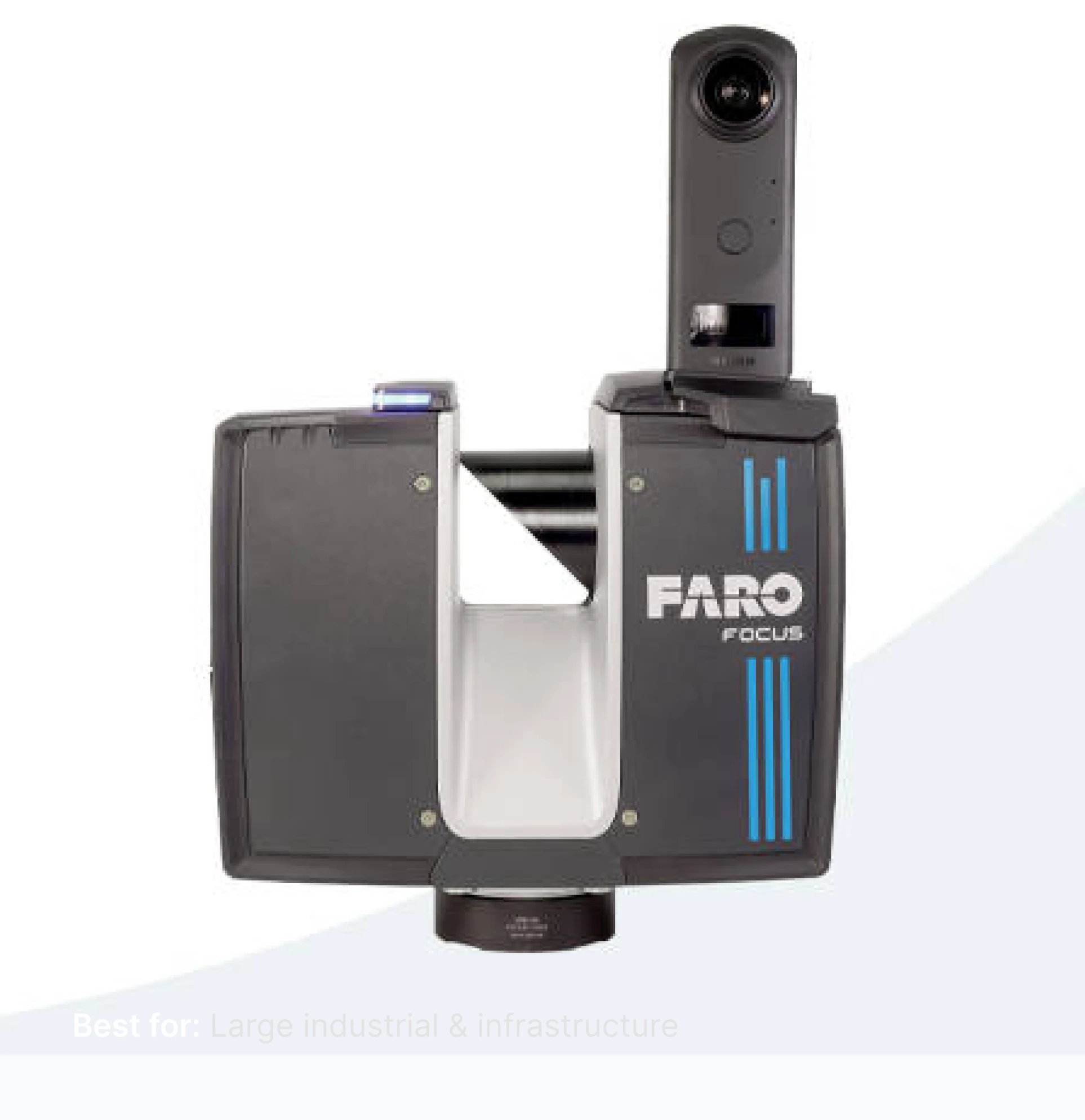
FARO® Focus Laser Scanner

The industry benchmark for precision terrestrial scanning. From tight interiors to open infrastructure sites stretching hundreds of metres, the Focus delivers sub 2mm accuracy with full colour panoramic capture and seamless cloud connectivity.

Range

Up to 400m

Accuracy

±1 to 2mm

Scan Speed

2M pts/sec

Weight

4.2kg

Clients Proof Points

Trusted by Industry Builders

Our Partners

Logo 4
Logo 3
Logo 2
Logo 1
Logo 4
Logo 3
Logo 2
Logo 1

Need Help Choosing?

Our FARO trained technical specialists can recommend the best model for your
project requirements.

Phone Number
Email Address
Our Location

Start The Conversation

Buy now scanner (#4)
Phone Number
Email Address
Our Location

Start The Conversation

Book a demo